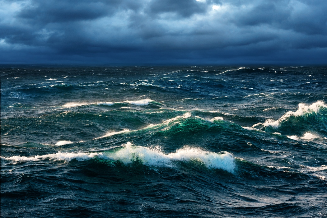
 Ocean waves are caused by wind blowing over the waters surface. They can travel thousands of miles and range in size from tiny wavelets to over 100 feet tall. Waves caused directly by the local wind are called wind waves. Wind waves are short, choppy, and tend to break (white cap) when winds reach approximately 17 miles per hour. Waves that travel outside of the area they were created, and are no longer the result of the local wind, are called ‘swell’. Compared to wind waves, swell are longer waves with smoother crests.
There are five factors that influence the formation, size, and speed of wind driven ocean waves:
- Wind speed or strength relative to wave speed- the wind must be moving faster than the wave crest for energy transfer
- The uninterrupted distance of open water over which the wind blows without significant change in direction (called the fetch)
- Width of area affected by fetch
- Wind duration - the time over which the wind has blown over a given area
- Water depth (In the case of RECON our wave sensors is in water approximately 30 feet deep)
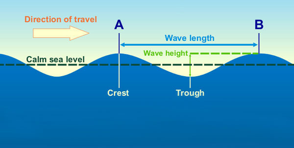
 Wave height is the measurement representing the size of the wave. Waves have two main parts. The wave crest is the top part of the wave and what people commonly refer to as a wave. The second half of the wave is the trough, the low point that comes in between two wave crests. A series of wave crests and wave troughs of different heights, frequencies, and directions is referred to as the wave spectrum.The wave height is the vertical distance between the wave trough and the wave crest.
There are several different ways wave height is reported. When RECON reports Wave Height it is referring to Significant Wave Height. This is the same wave height value that the NOAA marine forecast uses. It is as the average height of the highest one-third of waves in a wave spectrum and closely corresponds to what a trained observer would consider to be the average wave height. Devised by oceanographer Walter Munk during World War II, the significant wave height provides an estimation of wave heights recorded by a trained observer from a fixed point at sea.
As the following graph shows, a boater will experience a typical ‘wave spectrum’ during their activity, containing a low number of small waves (at the bottom) and a low number of very large waves (at the top). The greatest number of waves is indicated by the widest area of the spectrum curve. Note that the highest wave height of an individual wave will be significantly larger.
The highest one-third of waves is highlighted in dark blue in the graph below, and the average height of waves in this group is the significant wave height:

A forecast of 10 foot seas in open waters means a boater should expect to encounter a wave spectrum with many waves between 6 and 10 feet with a small percentage of waves reaching 16 feet and possibly even as large as 20 feet.
The Beaufort wind force scale is an empirical measure that relates wind speed to observed conditions at sea or on land. Developed in 1805 by Francis Beaufort, it can be used as a guide to estimate what wave heights can be expected for different wind speeds. It assumes open ocean conditions with unlimited fetch.
The Beaufort Scale
|
| Beaufort |
|
Wind Speed |
|
Wave |
| Number |
Description |
mph |
knots |
Sea Conditions |
Height (Ft) |
| 0 |
Calm |
0 |
0 |
Sea is like a mirror |
0 |
| 1 |
Light Air |
1-3 |
1- 3 |
Ripples with appearance of scales; no foam crests |
0.25 |
| 2 |
Light Breeze |
4-7 |
4 -6 |
Small wavelets; crests of glassy appearance, not breaking |
0.5 - 1 |
| 3 |
Gentle Breeze |
8-12 |
7 - 10 |
Large wavelets; crests begin to break; scattered whitecaps |
2 - 3 |
| 4 |
Moderate Breeze |
13-18 |
11 - 16 |
Small waves, becoming longer; numerous whitecaps |
3.5 - 5 |
| 5 |
Fresh Breeze |
19-24 |
17 - 21 |
Moderate waves, taking longer form; many whitecaps; some spray |
6 -8 |
| 6 |
Strong Breeze |
25-31 |
22 - 27 |
Larger waves forming; whitecaps everywhere; more spray |
9.5 - 13 |
| 7 |
Near Gale |
32-38 |
28 - 33 |
Sea heaps up; white foam from breaking waves begins to be blown in streaks |
13.5 - 19 |
| 8 |
Fresh Gale |
39-46 |
34 - 40 |
Moderately high waves of greater length; edges of crests begin to break into spindrift; foam is blown in well-marked streaks |
18 - 25 |
| 9 |
Strong Gale |
47-54 |
41 - 47 |
High waves; sea begins to roll; dense streaks of foam; spray may begin to reduce visibility |
23 - 32 |
| 10 |
Storm |
55-63 |
48 - 55 |
Very high waves with overhanging crests; sea takes white appearance as foam is blown in very dense streaks; rolling is heavy and visibility is reduced |
29 -41 |
| 11 |
Violent Storm |
64-72 |
56 - 63 |
Exceptionally high waves; sea covered with white foam patches; visibility further reduced |
37 - 52 |
| 12 |
Hurricane |
73+ |
64+ |
Huge waves. Sea is completely white with foam and spray. Air is filled with driving spray, greatly reducing visibility. |
45+
|
Disclaimer: Data presented on the RECON web site is provisional in nature and should not be used to make decisions that concern personal or public safety.


